
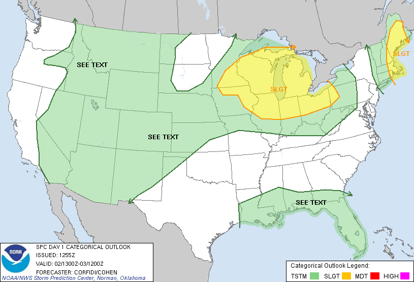
Discussion... A cold front will enter the Lower GL region and Midwest to ignite showers and storms. There is sufficient shearing in place in the S. WI/N. IL Eastward, so isolated tornadoes are possible in the more intense storms. Storms will develop this afternoon, and the tornado threat will evolve mostly in Wisconsin, but also in areas previously mentioned.
ATTM... Surface Based and MUCAPE parameters are in the 3000 j/kg range, with a slight to moderate region of CINH in portions of the slight risk area. Already.. Supercell Composites are considerably elevated in Wisconsin, mostly in western portions of the state. EHI's are elevated/somewhat high in West WI through IA and into parts of MO.
No comments:
Post a Comment